


CELINA A-102 Voting District, Mercer County, Ohio
About
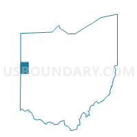
Outline

Summary
| Unique Area Identifier | 650010 |
| Name | CELINA A-102 Voting District |
| County | Mercer County |
| State | Ohio |
| Area (square miles) | 1.12 |
| Land Area (square miles) | 1.09 |
| Water Area (square miles) | 0.03 |
| % of Land Area | 97.50 |
| % of Water Area | 2.50 |
| Latitude of the Internal Point | 40.56360070 |
| Longtitude of the Internal Point | -84.53378400 |
Maps


Graphs
Select a template below for downloading or customizing gragh for CELINA A-102 Voting District, Mercer County, Ohio


Neighbors
Neighoring Voting District (by Name) Neighboring Voting District on the Map
- CELINA A-101 Voting District, Mercer County, OH
- CELINA A-103 Voting District, Mercer County, OH
- CELINA B Voting District, Mercer County, OH
- CELINA C Voting District, Mercer County, OH
- CENTER TOWNSHIP Voting District, Mercer County, OH
- EAST JEFFERSON NORTH Voting District, Mercer County, OH
Top 10 Neighboring County Subdivision (by Population) Neighboring County Subdivision on the Map
- Jefferson township, Mercer County, OH (13,155)
- Center township, Mercer County, OH (1,086)
- Wayne township, Mercer County, OH (11)